World Map Poster
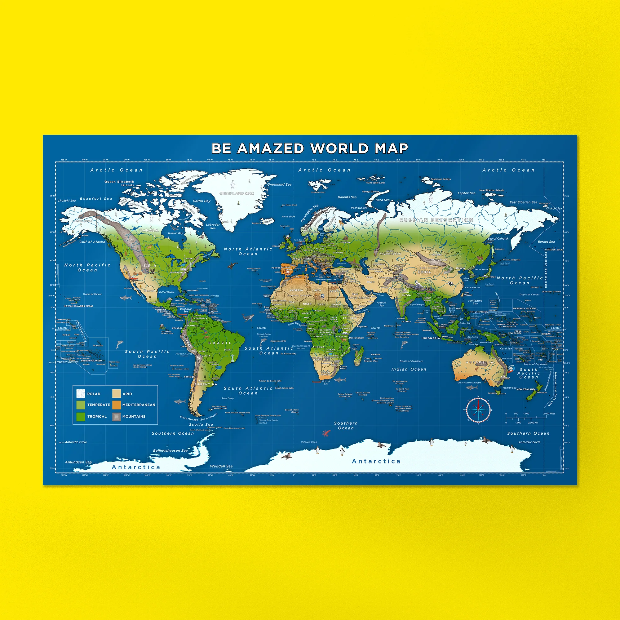
Bartholomew Eggbert Amazed traveled the world with a cartographer and they created a fun, illustrated, and accurate world map using the Miller projection. It features country names, capitals, simplified climate zones, illustrations of famous landmarks, fauna, and flora, besides illustrations of memorable chapters of the expedition, such as when Bartholomew danced Flamenco in Andalucia and climbed Mount Everest!
You can now explore the world with Bartholomew and decorate your room! This map is suitable for all ages, whether you want to learn more about geography or just want a cool poster to look at!
- Material: 180 gsm paper (semi-glossy)
- Dimensions: 34" x 22" (Horizontal)
- Miller Projection: It's a more accurate version of the popular Mercator projection, ideal for a recognizable world map that prioritizes a general worldview over size proportions.
Description
Bartholomew Eggbert Amazed traveled the world with a cartographer and they created a fun, illustrated, and accurate world map using the Miller projection. It features country names, capitals, simplified climate zones, illustrations of famous landmarks, fauna, and flora, besides illustrations of memorable chapters of the expedition, such as when Bartholomew danced Flamenco in Andalucia and climbed Mount Everest!
You can now explore the world with Bartholomew and decorate your room! This map is suitable for all ages, whether you want to learn more about geography or just want a cool poster to look at!
- Material: 180 gsm paper (semi-glossy)
- Dimensions: 34" x 22" (Horizontal)
- Miller Projection: It's a more accurate version of the popular Mercator projection, ideal for a recognizable world map that prioritizes a general worldview over size proportions.